
Netivot Masterplan
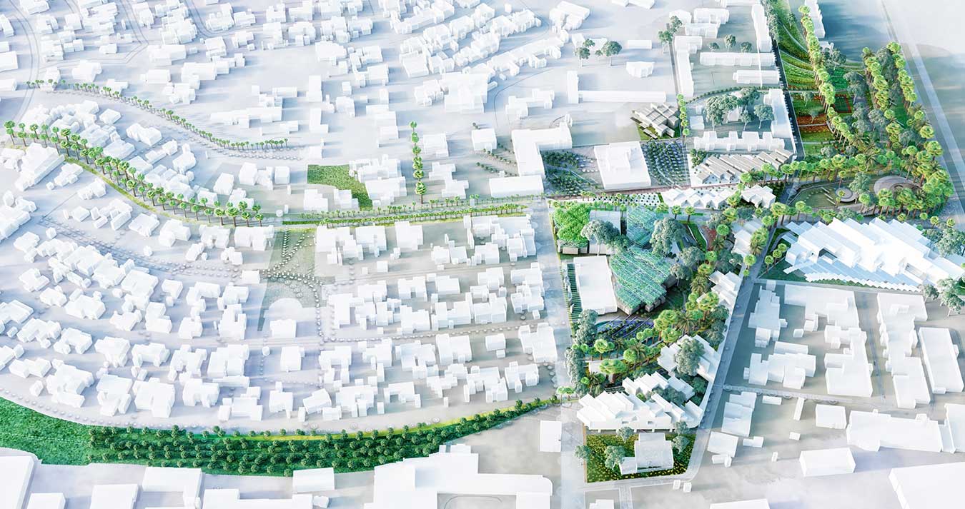
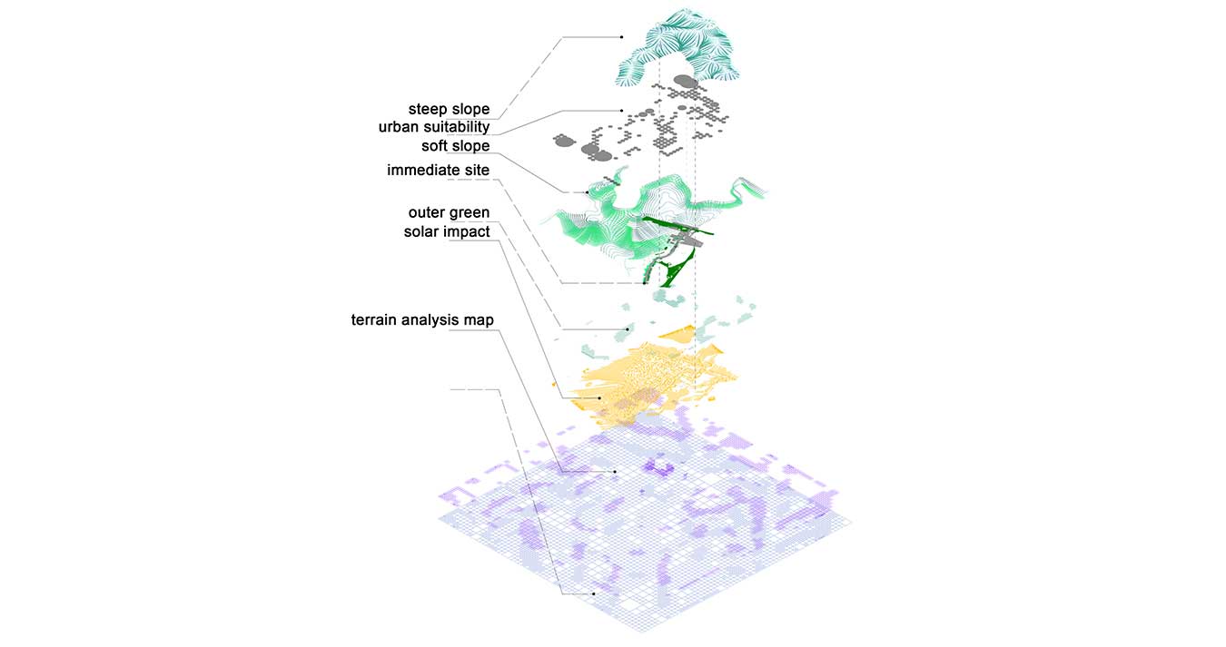
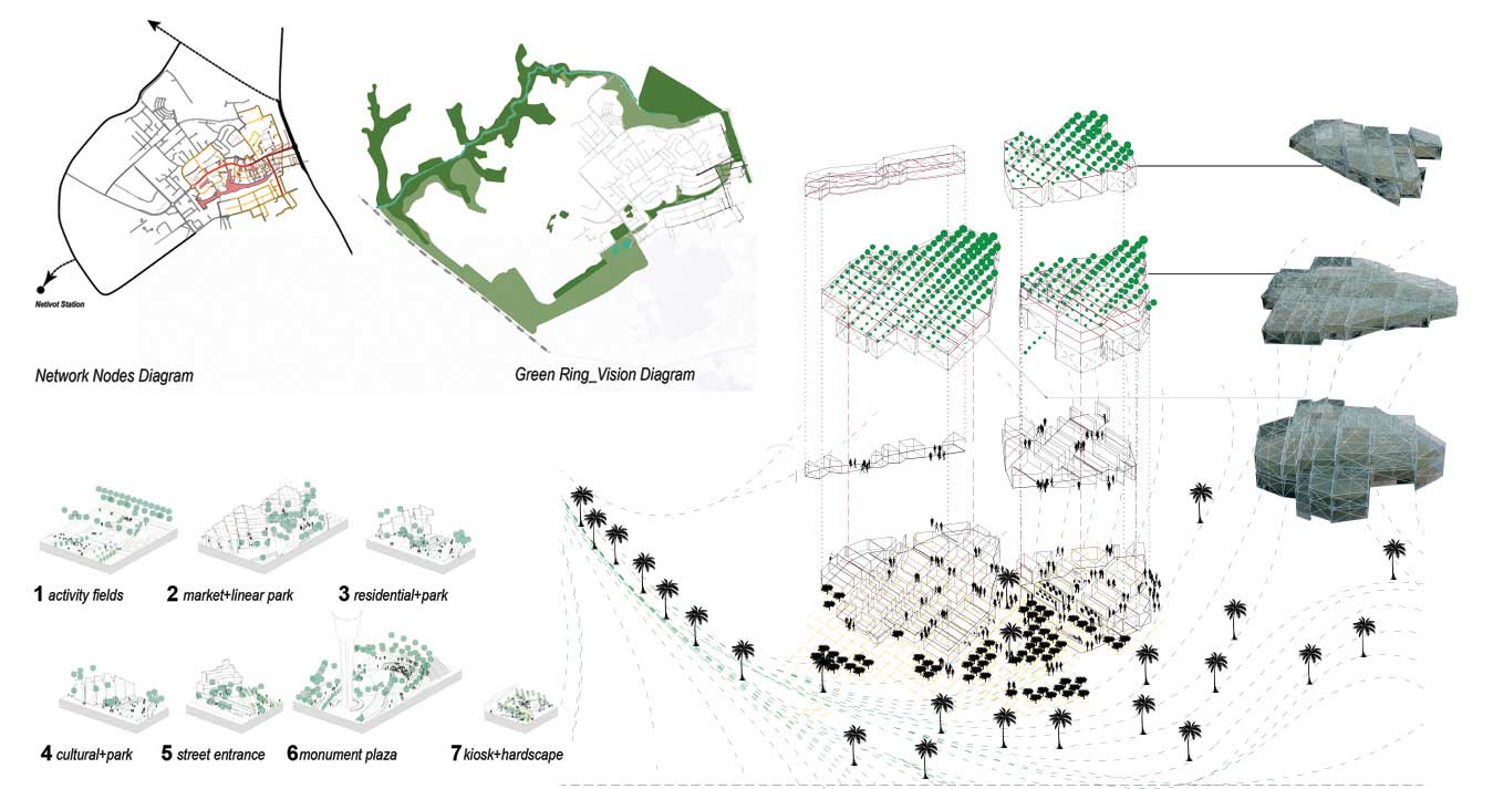
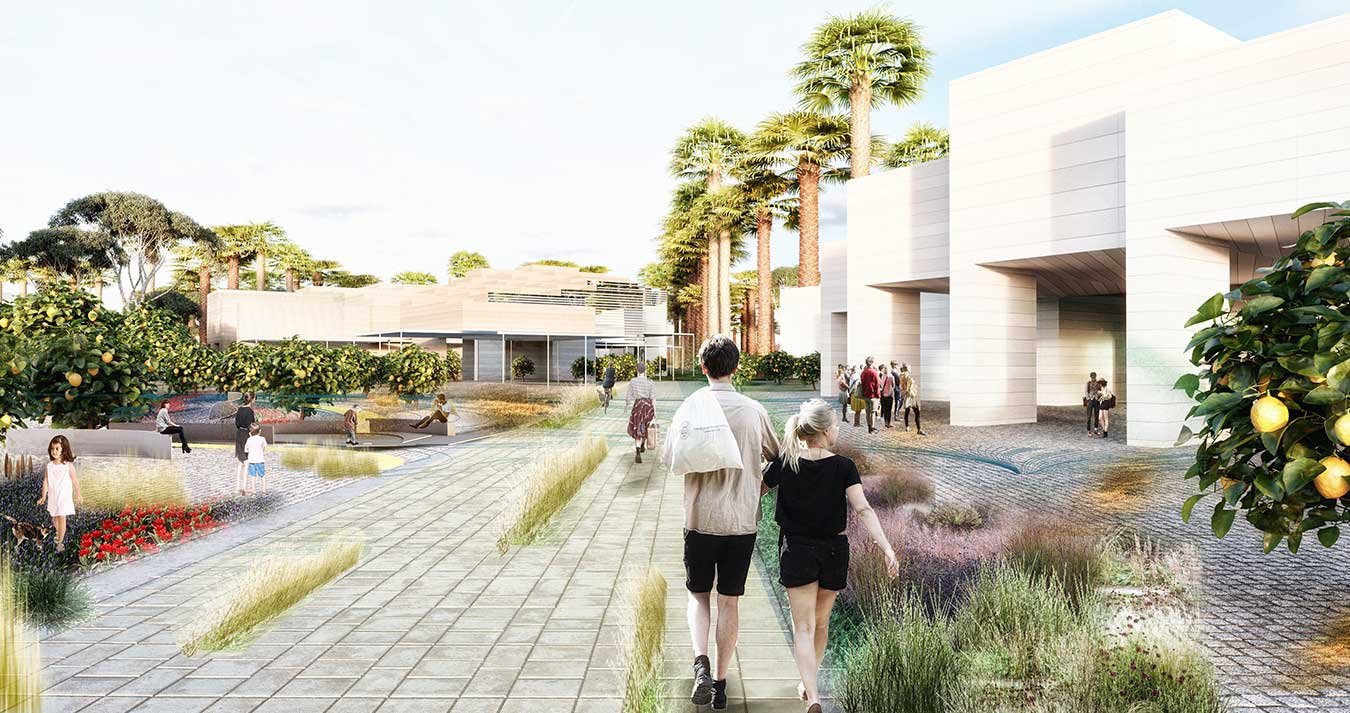
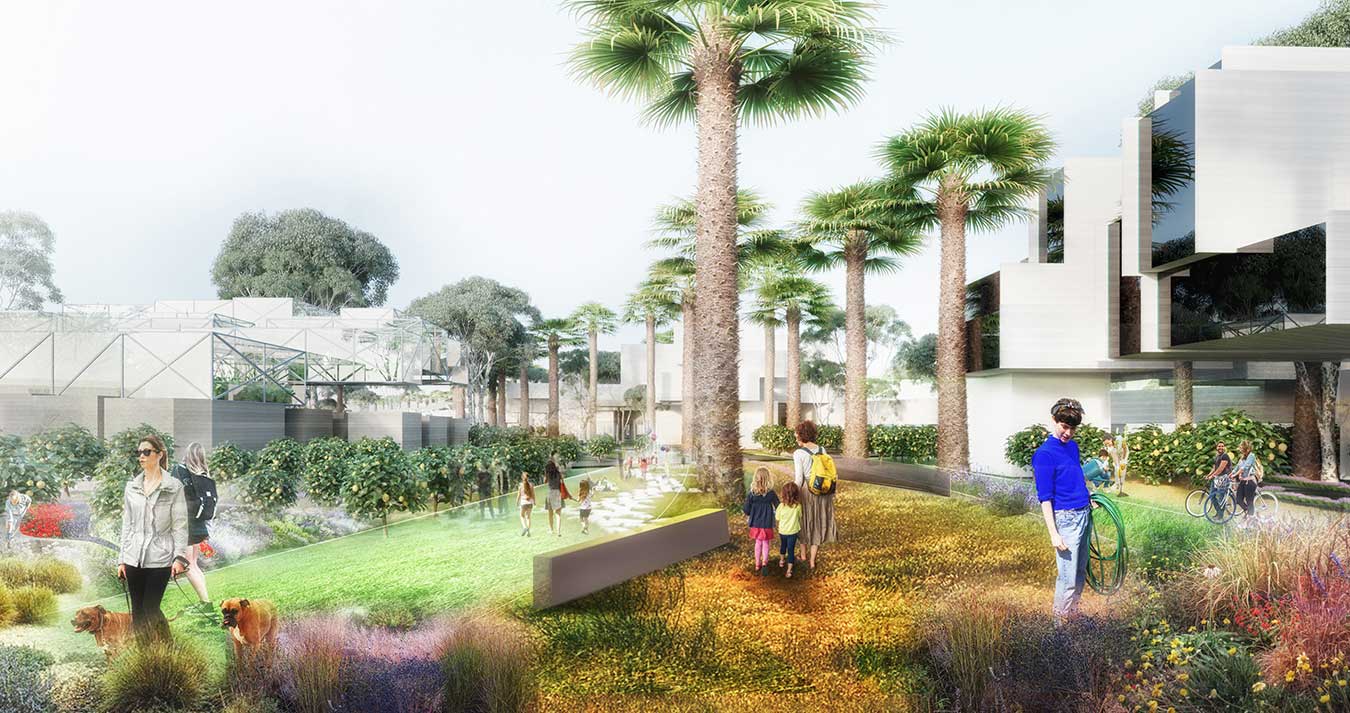
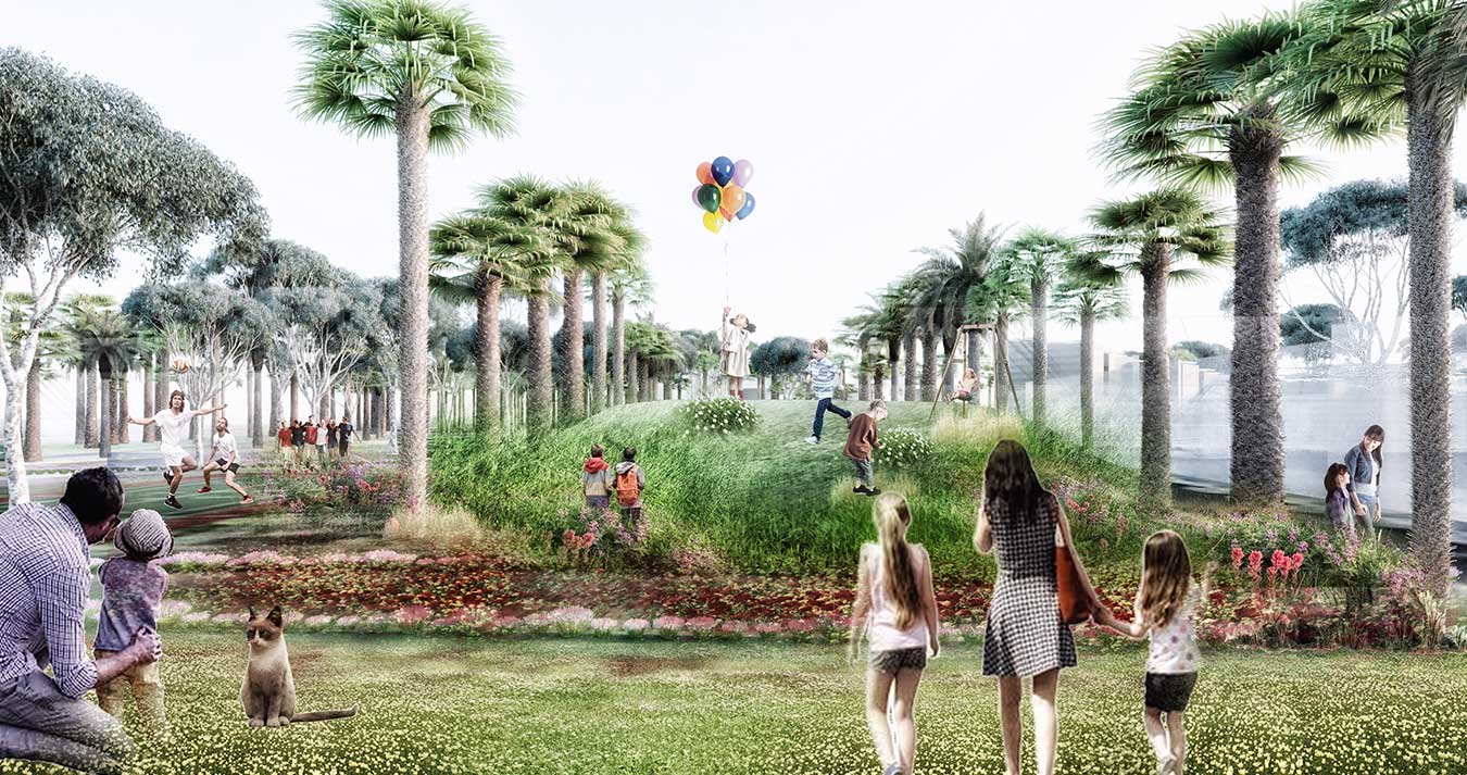
The proposed urban fabric follows the environmental logic in order to create micro-climatic conditions and provide a good urban environment particularly in the hottest months of the year. The urban fabric, the canopies and the urban shelter are oriented North-West to South-East. This orientation aims to capture the fresh air coming from the sea. The proposed structure of public space aims to provide continuity to the existing public spaces in Netivot, it does so by closing the loop of a metropolitan green corridor that ring fences the city. This strategic decision facilitates the use of alternative forms of mobility such as cycling. By understanding how the desire lines intersect a hierarchy of principal routes can be defined. These in turn define “nodes” of increased activity. At these nodes’ greater capacity for public movement and the opportunity to create places to pause and enjoy the amenity should be combined with active frontages to local landmarks.
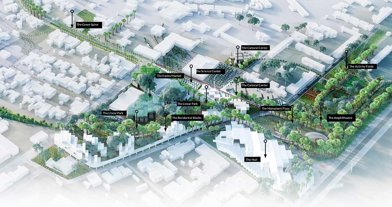
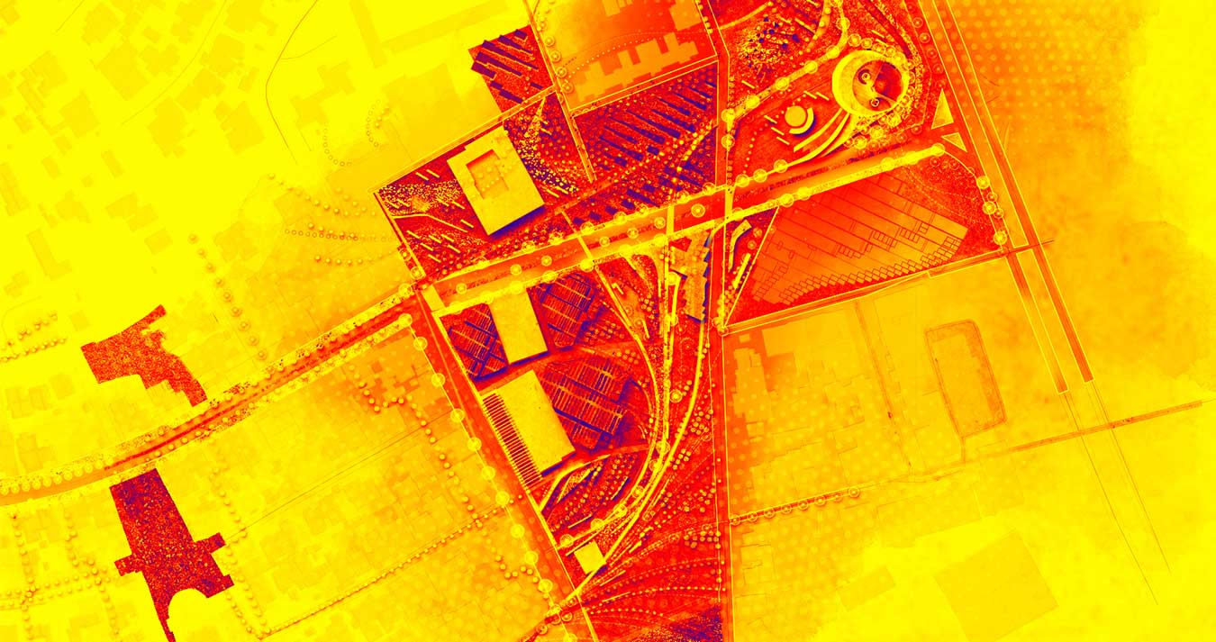
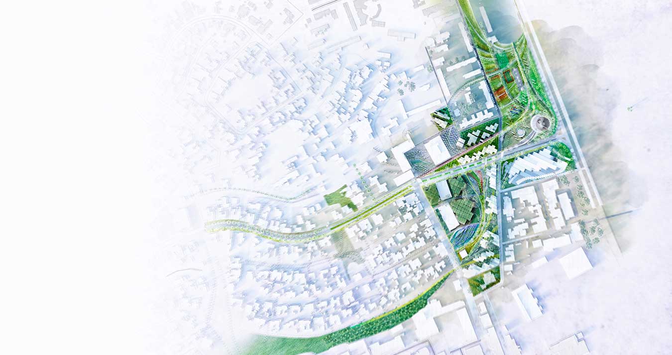
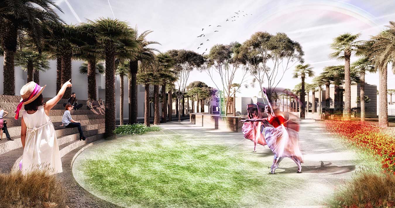
The project proposes to divide Siderot Yerushalahayim High Street into five sections, each section aims to bring a specific character. Section (A) starting from the West end until Hafes Heim Street, is characterized by the tree shelter located on both sides of the pavement. Sections (B) and (C) have a boulevard in the middle aiming to improve the north-south connectivity between the different public spaces. The character proposed for this street section is like Sderot Ben Gurion in Haifa. From section (C) to (D) and (E) the street is diverted into two street taking a Y shape. The north branch is a pedestrian axis and aligns to the facade of the City Hall, The New Cultural Center and arrives to The Memorial Monument to Yaldei Oslo and a proposed open air Amphitheatre. These two elements the high street ending in Y (Shown in red) and the green spine (Shown in green) are the two main elements in the network hierarchy. The street network shown in orange, provides continuity to the existing urban network. A smaller shared surface network shown in blue provides the city center with a historical, human scale character.
- [COMPETITION THIRD PRIZE]
- [status] ideas
- [location] Netivot, Israel.
- [program] Master-planning
- [date] 2018
- [area] 20000 m2
- [credits] in progress
Netivot Masterplan
The proposed urban fabric follows the environmental logic in order to create micro-climatic conditions and provide a good urban environment particularly in the hottest months of the year. The urban fabric, the canopies and the urban shelter are oriented North-West to South-East. This orientation aims to capture the fresh air coming from the sea. The proposed structure of public space aims to provide continuity to the existing public spaces in Netivot, it does so by closing the loop of a metropolitan green corridor that ring fences the city. This strategic decision facilitates the use of alternative forms of mobility such as cycling. By understanding how the desire lines intersect a hierarchy of principal routes can be defined. These in turn define “nodes” of increased activity. At these nodes’ greater capacity for public movement and the opportunity to create places to pause and enjoy the amenity should be combined with active frontages to local landmarks.
The project proposes to divide Siderot Yerushalahayim High Street into five sections, each section aims to bring a specific character. Section (A) starting from the West end until Hafes Heim Street, is characterized by the tree shelter located on both sides of the pavement. Sections (B) and (C) have a boulevard in the middle aiming to improve the north-south connectivity between the different public spaces. The character proposed for this street section is like Sderot Ben Gurion in Haifa. From section (C) to (D) and (E) the street is diverted into two street taking a Y shape. The north branch is a pedestrian axis and aligns to the facade of the City Hall, The New Cultural Center and arrives to The Memorial Monument to Yaldei Oslo and a proposed open air Amphitheatre. These two elements the high street ending in Y (Shown in red) and the green spine (Shown in green) are the two main elements in the network hierarchy. The street network shown in orange, provides continuity to the existing urban network. A smaller shared surface network shown in blue provides the city center with a historical, human scale character.